
Sam Hallas' Website
These pictures were passed onto me by Bob Freshwater as rescued from GEC's factory before demolition. Click on a picture to open the gallery view for a larger picture. Use right and left arrows to move forward and backward through the gallery.
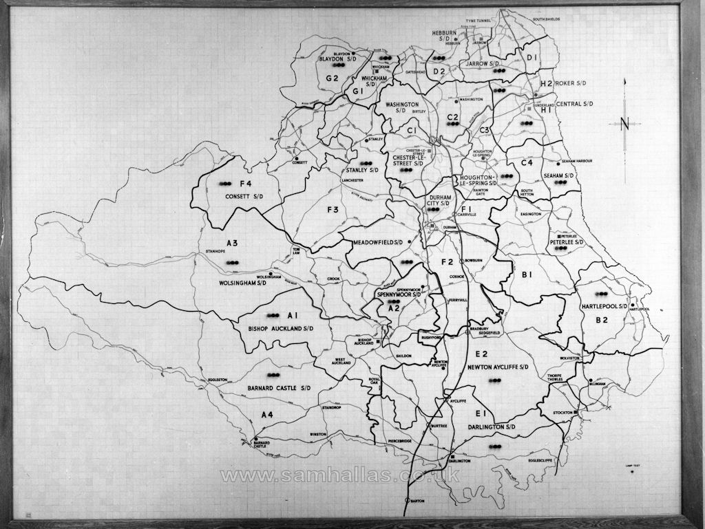
 Left: The map of the area covered by the Control Centre. The broad line of the A1(M) can be seen running roughly North-South. The motorway junctions are shown as small
circles. Junction 56, Barton Park Services and Interchange is at the bottom of the map. Junction 63. Chester-le-Street Interchange is at the top.
This section of the motorway was opened between Sep 1969 and Apr 1970.
Left: The map of the area covered by the Control Centre. The broad line of the A1(M) can be seen running roughly North-South. The motorway junctions are shown as small
circles. Junction 56, Barton Park Services and Interchange is at the bottom of the map. Junction 63. Chester-le-Street Interchange is at the top.
This section of the motorway was opened between Sep 1969 and Apr 1970.
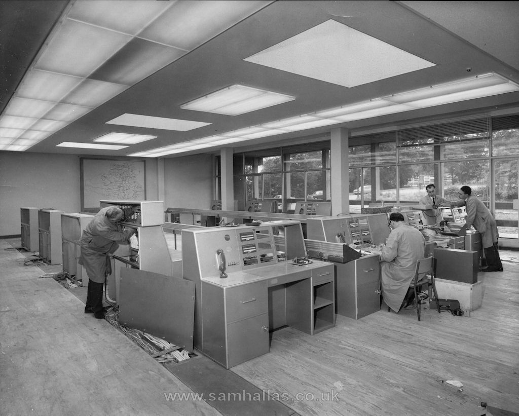
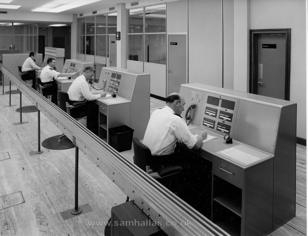
Right: GEC technicians are shown completing the wiring during installation of the control desks.
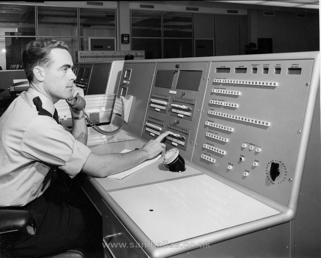
Operators using the consoles for vehicle despatch and radio calls. Detailed examination reveals that the
bottom left key & lamp unit contained incoming public exchange lines. The top left one had 3-figure numbers, presumably
local PABX extensions.
The large panel with illuminated push buttons appears to be a selective mobile radio control desk. Selection
is by call-sign letter followed by two digits.
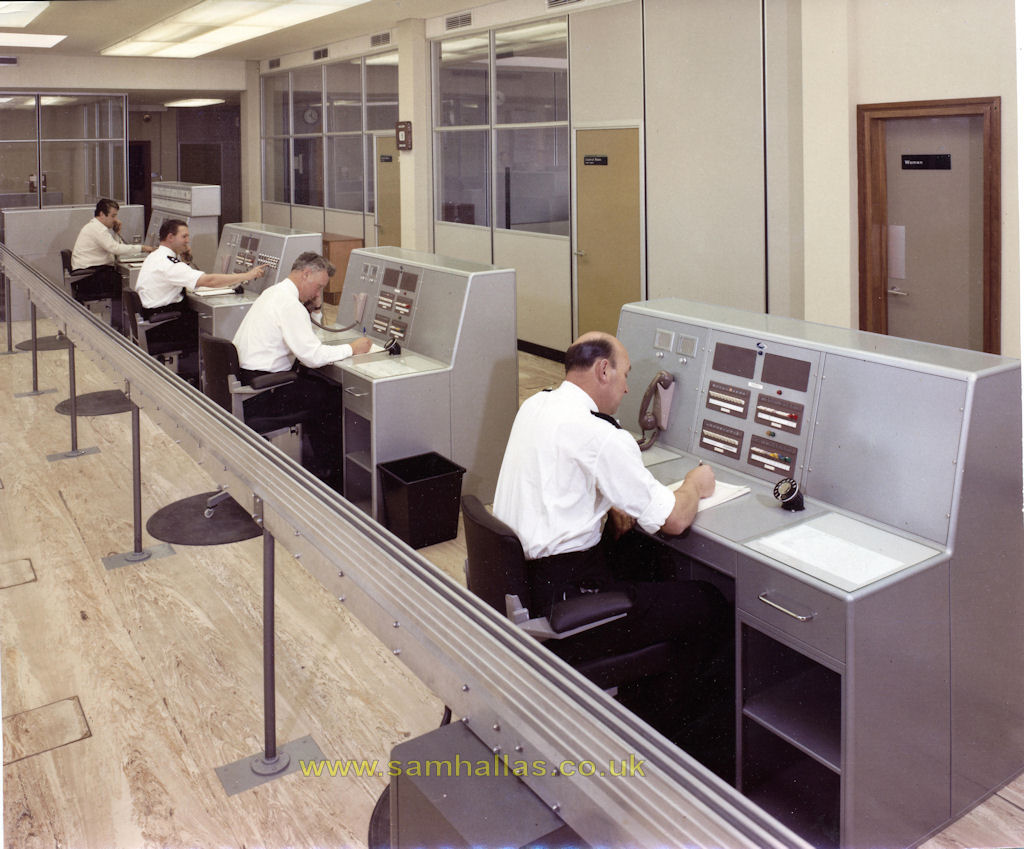
Some of the pictures came in both monochrome and colour.
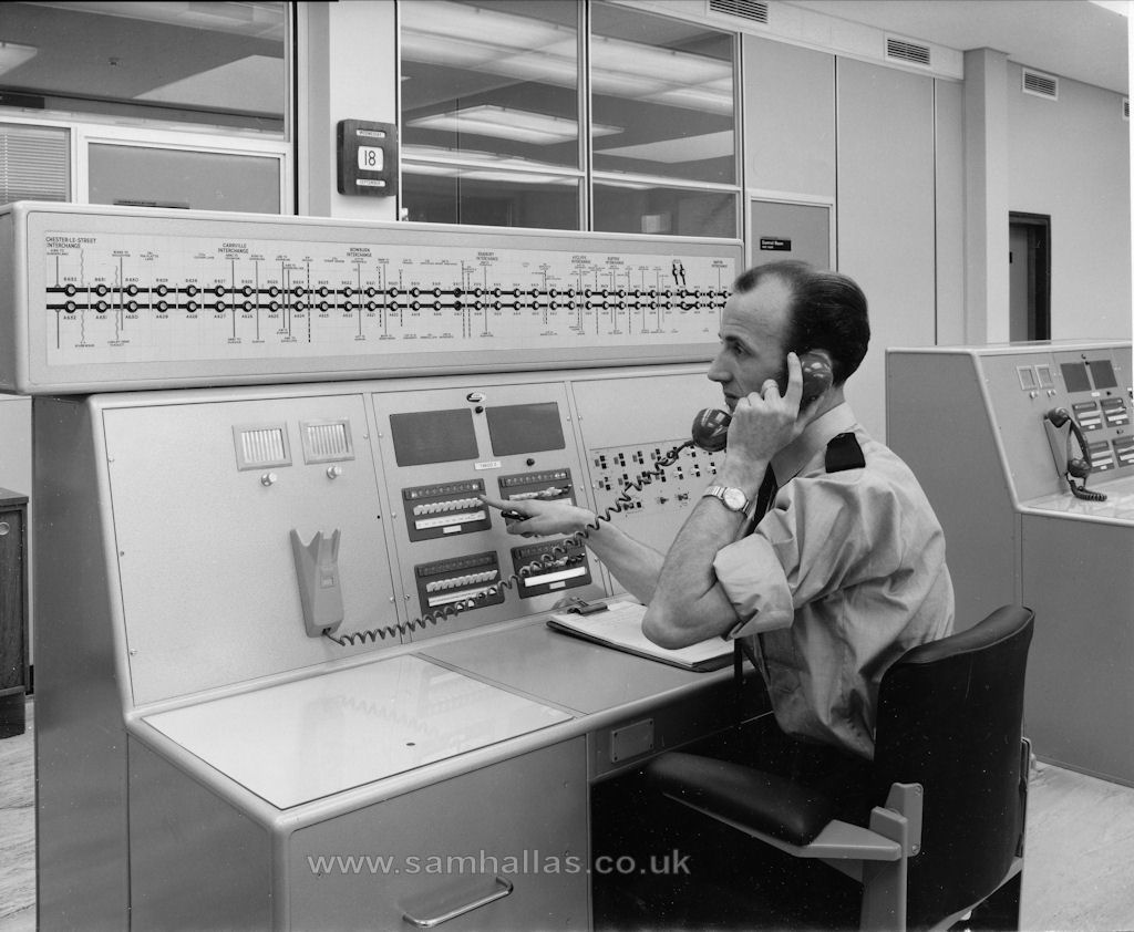
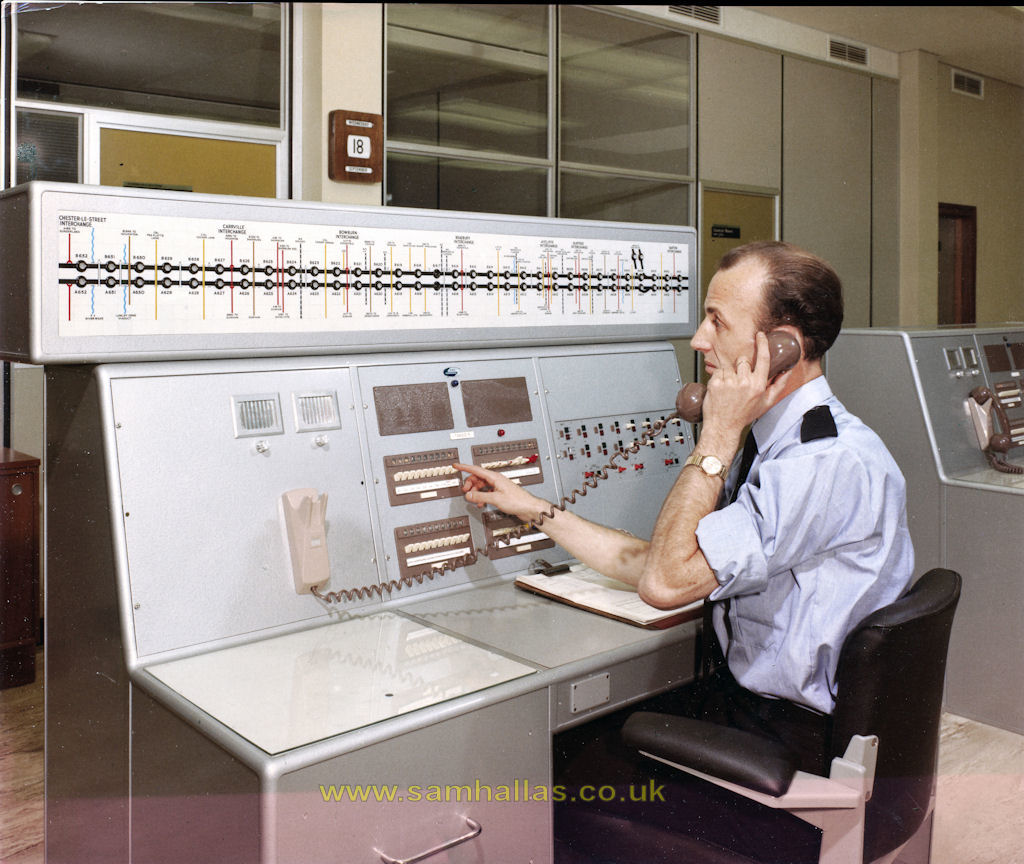
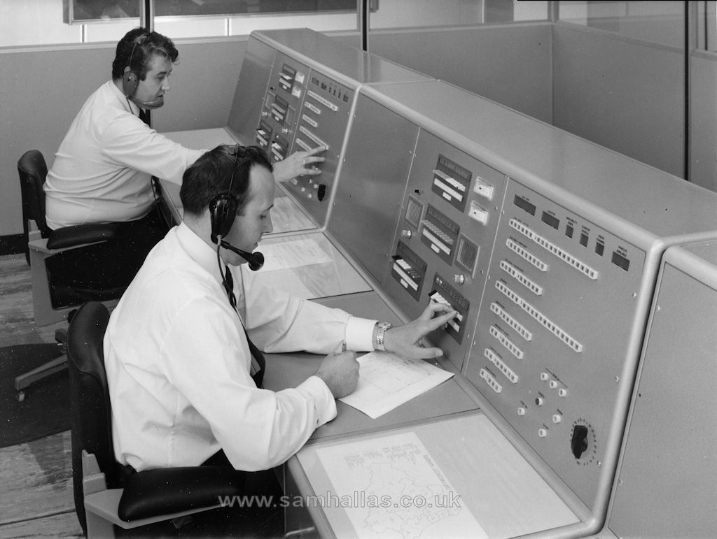
This operator answers calls from the roadside assistance telephnes. The display above shows calling lamps with the location of each telephone
against a linear map of the motorway. Chester-le-Street (Junction 56) at the left-hand end and Barton Interchange and Services (Junction 63) on the right-hand end.